for GARMIN GPS
(unofficial site)
| News | Maps |
  |
Links |
Info |
| Introduction I have decided to open this simple web site for passion and because, reading forums, I have noticed that many persons looking for italian topographical cartography (and not) for Garmin units. A digital cartography that for Italy is lacks, regarding many other countries. I hope therefore to stimulate such development of trade experts and in the meantime to satisfy fond of like me. Unfortunately the time that I can dedicate to hobby is much limited, I make excuses for the long times between updates or new maps. I invite all, to participate actively with proposals, ideas and advices. Alessandro
|
News
| 05/05/08 | Here the link to download Itopo20... | |
| 04/03/06 | Little
problem on Itopo products uninstall, I'm sorry. The uninstall process
don't delete registry keys with consequently window error on MapSource
use. New ITopo_setup files without bug are ready for downolad, look at
(*) near the name for it. Uninstall old version and use new setup file,
thank you. |
|
| 12/01/06 | Ready to
download: ITopo20
with
20m contour lines. |
|
| 03/12/05 | New corrected
ITopo100 v2.1
available for download. It's an exe setup file. |
|
| 01/12/05 | For few web space
available and installation difficults ITopo50 v1.1
sobstitute v1.0. This new file isn't zip
archive but autoinstall exe. The update from 1.0 to 1.1 again available for everyone. |
|
| 24/11/05 | Download update
for Itopo50. |
|
| 11/11/05 | New collaboration
with : to get
a complete Italy Topo Maps. to get
a complete Italy Topo Maps. |
|
| 05/11/05 | ATTENTION! I haven't more free web's data to generate new ITopo maps, so I ask help from everyone. I wish get new detailed topo maps with tographical POI: summit, cross, camps and so on naturals and not point of interest for trekking, skiing, bicycling... Everyone interested about this project can send by mail the waypoint records along the way, I'll convert these waypoint on new updates for ITopo map. Thank you very much. |
|
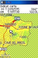
| 24/10/05 |
Ready
to download ITopo50
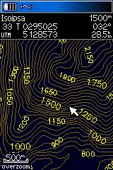
with 50m contour lines! |
Maps
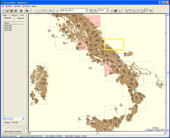
| ITALY
TOPO 100 (18,2Mb)
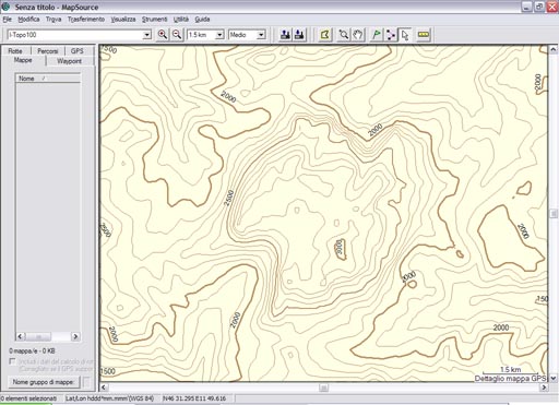
Free map. Work with MapSource or Sendmap softwares. Italy's map with 100m contour lines. Trasparent map usable with original Garmin products. From: DEM srtm 30. |
|
|||||||
|
ITALY TOPO 100 v.2 (18,5Mb) version 2.1 (19Mb) (*) Delete v.2 before install! Free map. Work with MapSource or Sendmap softwares. Italy's map with 100m contour lines, regionals and provinces contourns. Trasparent map usable with original Garmin products. From: DEM srtm 30. |
 |
|||||||
| ITALY TOPO 50 v.1 (41Mb) version 1.1 (41Mb) (*) Free map. Work with MapSource or Sendmap softwares. Italy's map with 50m contour lines. Trasparent map usable with original Garmin products. From: DEM srtm 30. The single map name of every *.img file rapresent the left down corner coordinates. example: 40001200 -----> 40°.00'N - 12°.00'E UPDATES:
|
|
|||||||
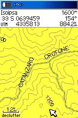
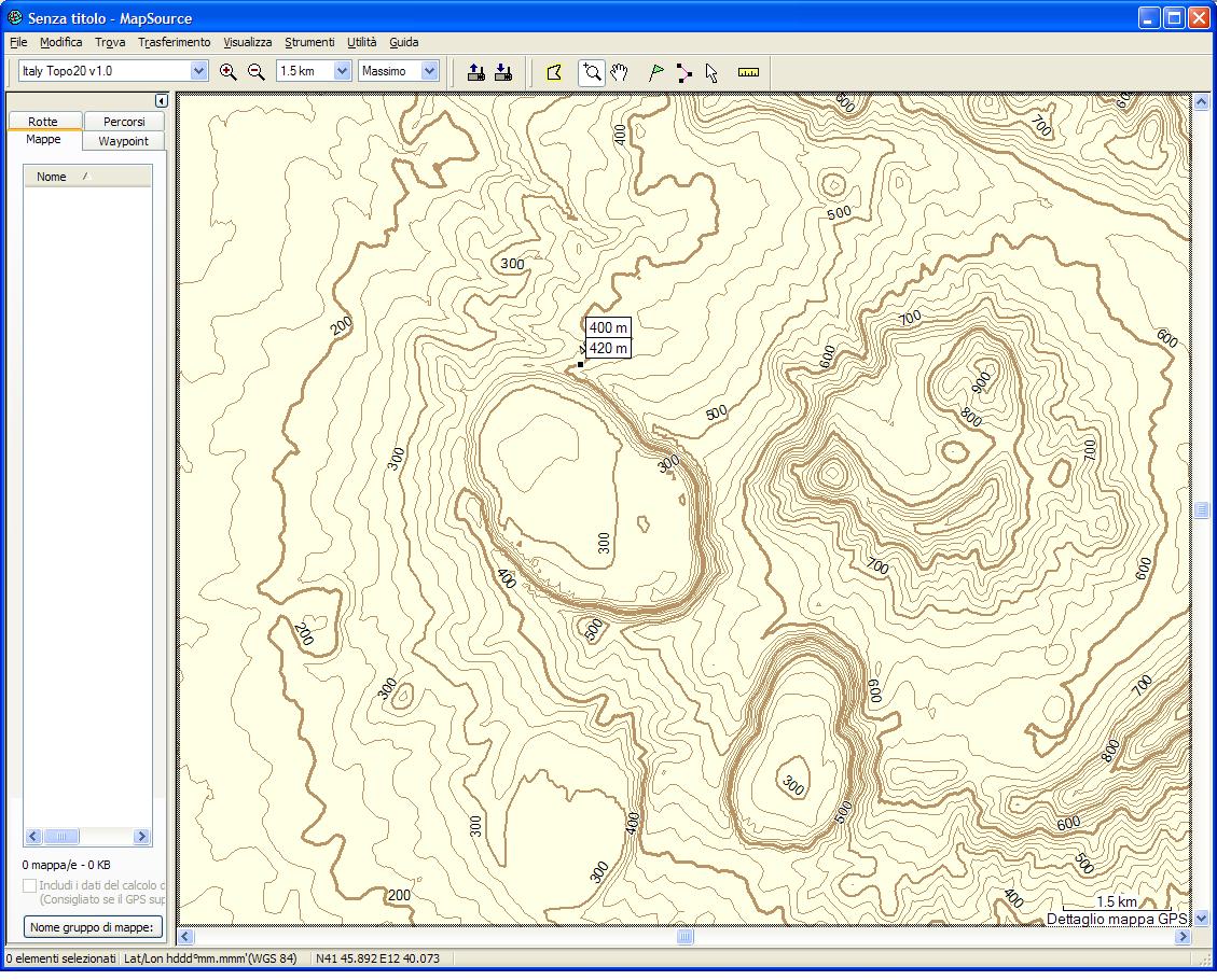
ITALY TOPO 20 version 1.0 (79Mb) Free map. Work with MapSource softwares. Italy's map with 20m contour lines. Trasparent map usable with original Garmin products. From: DEM srtm 30. |
 |


Links
| gps web sites |
GPS
users |
ON
LINE maps |
cartographic
SOFTWARE |
FORUM |
| GARMIN International Garmin Italia - Synergy GPScomefare |
Geocaching
international GeoCaching (Italy) PaoloVitali & SonjaBrambati Rif.&Biv. V.D'Aosta(C.Frezet) I viaggi di Taddy&Gloria |
MapCenter Richard's Maps madmappers(Africa) Scottish mount. club Free Maps List |
Cgpsmapper e Sendmap GPSMapedit Mapwel 2005 ImgtoGps |
free.it.discussioni.gps gps-italia (yahoo) www.gpsitalia.tk |
Info
Attention: you use these products at your own risk.

Last update: 05/05/08