|
|
|
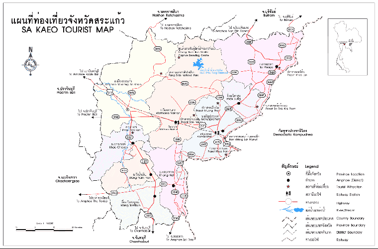
SAKAEO |
|
|
|
 |
| |
|
|
 |
| |
|
|
Located in the
eastern border of Thailand, facing Cambodia at Aranyaprathet, Sa Kaeo is
a popular province known as a trading centre
In the past, Sa Kaeo was a major civilized community. Its
long history had dated back since the Suwannaphum and Dvaravati Periods.
The archeological sites of Khmer arts and stone inscriptions are the
outstanding examples of this civilization.
Administratively, Sa Kaeo has been a district of Prachin Buri Province
for a long period, and has officially been upgraded as a province since
December 1, 1993.
Sa Kaeo is 245 kilometres, east of Bangkok, with the area about 7,195
square kilometres. Sa Kaeo is divided into 7 Amphoes (districts) and 2
King Amphoe (sub-districts): Amphoe Muang, Amphoe Watthana Nakhon,
Amphoe Aranyaprathet, Amphoe Ta Phraya, Amphoe Khao Chakan, Amphoe Wang
Nam Yen, Amphoe Khlong Hat, King Amphoe Khok Sung, and King Amphoe Wang
Somboon.
Geographical
Location
Sa Kaeo has its border facing Cambodia of approximately 165 kilometres.
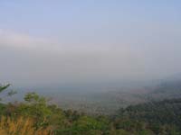
Generally, the area varies from plains to highlands. Highlands and
mountains are in the north where Pang Sida National Park is located,
while the south is covered with wavy plains and hills. Also, there are
evergreen forests along the Chanthaburi mountain range. In the central,
there are plains and hills, with Amphoe Watthana Nakhon as the highest
area when compared to the other Amphoe Mueang in the west, and Amphoe
Aranyaprathet in the east.
I live in Saralumduan, at
the amphoe Muang, baby to 20 Km from Sakaeo.
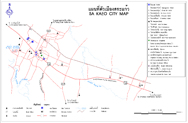
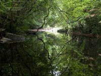
Sa
Kaeo - Sa Khwan
These
two ponds are located in Tambon Sa Kaeo on the western side of town.
Before approaching the city, turn right at 246th kilometer. It is
believed that these two ponds contain sacred water once used for the
coronation ceremony. The name of the province ( Sa Kaeo) had been
derived from this venue, whereby Somdej Chaophraya Maha Kasatsuk (King
Rama I later) went to fight with the Cambodians, and stopped at this
site to use sacred water to swear for the fighting courage.
|
| |
|
|
 |
 |
|
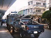
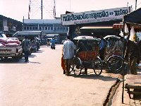
The
principal street ... |
Street
of market... |
|
 |
 |
|
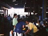
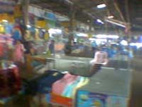
Market.. |
Market.. |
|
 |
 |
|
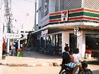
The
mini-market Seven-Eleven |
The
tuk-tuk's stop |
|
 |
 |
|
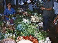
Market.. |
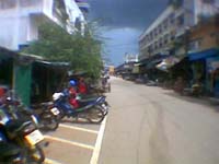
Street near market... |
|
Attractions:
|
|
 |
 |
| |
|
|
 |
 |
 |
| |
|
|
 |
 |
 |
| |
|
|
 |
 |
 |
| |
|
|
 |
 |
 |
| |
|
|
 |
 |
 |
| |
|
|
 |
 |
 |
| |
|
|
 |
 |
| |
|
|
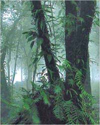
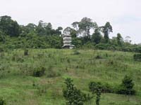
Pang Sida National Park
General Information
Covering the area in Amphoe Muang, Amphoe Wattana Nakhon, Amphoe Ta
Phraya of Sa Kaeo and Amphoe Na Di of Prachin Buri, the Park
occupies an area of 844 square kilometres or 527,500 Rai. It was
designated a national park on 22 February 1982 to be the 41st
national park of Thailand. The topography of the area consists of
complex highlands with various and diversified forests, and an
abundant of wild and rare animals.
The
area is the origin of many creeks which form the Bang Pakong River.
The major attractions in the park are:
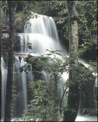
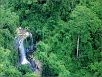
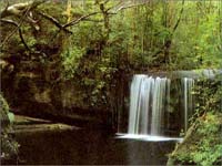
Namtok Pang Sida (Pang Sida Waterfall) The waterfall is
approximately 800 metres from the park office. With a large pond
below the 10 metre waterfall, the surroundings are very shady, with
much water during the rainy season.
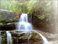
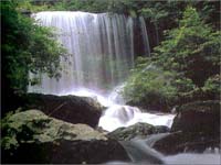
Namtok Pha Takhian About 3 kilometres from the park office, and
about 2.5 kilometres from Namtok Pang Sida, the 10 metre waterfall
can be reached by 2 trekking trails which are suitable for nature
study.
Tha Krabak Reservoir Built under H.M.the King�s project to improve
the irrigation, the reservoir is located in Moo 7 Tambon Tha Yaek,
about 32 kilometres from town. It is a dam that is 17.50 metres
high, and 720 metres long, surrounded by various kinds of forests.
Its spectacular views are most suitable for relaxation.
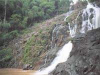
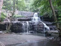
Tha Krabak Waterfall This waterfall is near the reservoir, with 3
levels which are 400-500 metres apart.
Khwae Makha Waterfall Khwae Makha Waterfall is about 6 kilometres
from the 40th kilometre. It is approximately 70 metres high. The
trail is suitable for trekking. Nearby, there are various waterfalls
located at different distances from Kwae Maka Waterfall. These
waterfalls are Rak Sai Yoi Waterfall (500 metres), Lan Hin Yai
Waterfall (1.5 kilometres), Suan Man and Suan Thong Waterfalls (3
kilometres), Man Thara Waterfall ( 4 kilometres ). To discover these
waterfalls, you might need to spend 2-3 days because they are
located deep into the forest.
Tham Khang Khao Waterfall The waterfall can be reached by a walking
distance of about 10 kilometres from the 22th kilometre. There are
many bats living in this area.
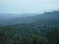
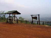
View Point Situated in the huge valley at the 25th and 35th
kilometres, sunrise and sunset can be watched here at this view
point.
Fresh Water Crocodile From the park office about 5 kilometres, to
Moo Ban Khlong Phak Khom- Thung Pho for about 50 kilometres, this
source in Huai Nam Yen Forest, has been surveyed since 1991.
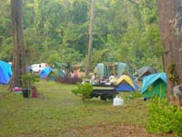
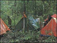
Accommodation
The National
Park has house renting service at 500-600 Baht per night. Tent area
is also available at the rate of 5 Baht/person/night. For more
details, contact Pang Sida National Park, P.O.Box 55, Tambon Tha
Yaek, Amphoe Mueang, Sa Kaeo 27000, Tel: 0 1947 5948 or National
Park Div., Dept. of Forestry, Bangkhen, Bangkok at Tel: 0 2561 4292
ext. 724, 725, or 0 2579 5734, 0 2579 7223.
Traveling By
Car: From town,
heading north by using Highway No.3462 about 27 kilometres, the
National Park is on the right. If tourists need to travel by public
transportation, they can use mini-cab route Sa Kaeo � Ban Khlong Nam
Khiao for about 27 kilometres to the park office. Another route is
by train (Bangkok � Aranyaprathet), getting off at Sa Kaeo Station,
then use mini-cab as mentioned above.
Topography
The landscape is complex high mountains. It is fertile and composed
of many kinds of plants. The forests include moist evergreen forest,
dry evergreen forest, dipterocarp forest and grassland which are the
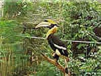
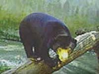
important sources of water and streams. Wild animals found in the
park, for examples, bull, elephant, red bull, tiger, deer, barking
deer, bear, warthog, and hornbill. Tourists can easily see the wild
animals living in the nature like Khao Yai National Park. There was
also found white-water crocodiles in the year 1991 in the area of
Huay Nam Yen Forest, Amphur Muang , Sa Kaeo Province. It was
expected to be the biggest and the last living place for crocodiles
in Thailand.
Climate
Most of the area is rain forest and in monsoon climate that causes
rain regularly so that the temperature is not so hot. The rainy
season starts from June to November. The winter is from December to
February; approximately temperature is 8 � 15 degrees Celsius. The
summer is from March to May.
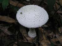
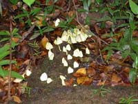
Flora and Fauna
The forest in Pang Sida National Park is rain forest, semi-evergreen
forest, montane forest and deciduous forest. There have valuable
plants such as Yang, Krabak (a kind of Dipterocaparceae), Red Hopea,
Makhaa mong, Tabak (a kind of Lagerstroemia), Sela (a kind of
Lythreceae), Burmese ebony, hog plum, Samor (a kind of Terminalia)
black wood and rosewood, each spreading in a forest of its kind, and
lower plants such as rattan, fernmoss and many kinds of ground
orchid.
Because the forest in this area is productive forest, and the source
of many rivers, so that there is a good habitat for wild animals,
every big and small size and more than 200 kinds of bird, found and
spreading there, such as wild elephant, seladang, banteng, tiger,
Asiatic black bear, hill myna and dove, and also rare fresh-water
crocodile. |
| |
|
 |
 |
| |
|
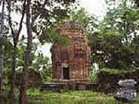
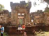
Prasat Khao Noi:
This site is
situated in Wat Khao Noi Si Chomphu, Tambon Khlong Nam Sai, which is
12 kilometres to the south of the city. This ancient venue is on the
80 metre hill. With the stairs of 254 steps, this site is composed
of three towers (prang). However, only the central one has been
remained. It has been registered in year 1935 by the Department of
Fine Arts as the national ancient site. Some sandstone lintels and
statues were found, and they are now displayed at the Prachin Buri
National Museum. |
|
|
|
|
 |
 |
| |
|
|
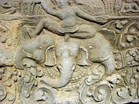
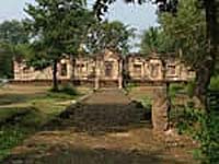
Prasat Sadokkokthom:
This ancient archeological venue, with three temples, is located at
Ban Nong Samet. Facing to the east, with 4-side moat , a group of
sandstone towers ( prang ) stand inside the laterite walls. Two
Khmer stone inscriptions were found and are now kept in the National
Library. Tourists can use the road Aranyaprathet - Ta Phraya, turn
right at Ban Nong Mek. It is about 36 kilometers from Aranyaprathet. |
| |
|
 |
 |
| |
|
Aranyaprathet
Victory Gate
Situated on the Thailand � Cambodia border at Ban Khlong Luek,
Tambon Tha Kham, the gate was constructed in 1939. The shape of the
gate consists of two octagonal 15 metre towers, with the base used
as the guarding area. These towers were destroyed by war. In 1959,
the left tower was reconstructed in the same shape to commemorate
the dead and injured soldiers. The right tower was altered to a huge
marble heart-shaped boundary stone facing Cambodia, with the Garuda
(mythical bird-man ) image on top, and the name �Thailand� below.
Phra Siam Dewathiraj
Located in front of Aranyaprathet Police Station, with the height of
1.29 meters, this is the imitation of the real Phra Siam Dewathiraj,
built by Phra Uthai Thammathari in 1975. The people of Aranyaprathet
constructed a throne with four posts to house the image on December
20, 1985. This sacred image has been worshipped by the people of
Aranyaprathet and nearby provinces.
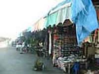
Ban Khlong Luek Border Market
It
is also known as Talad (Market) Rong Kluea, which is in Ban Khlong
Luek, Tambon Tha Kham on Thailand - Cambodia border, east to
Aranyaprathet town about 6 kilometers, on Highway No.33 (Sa Kaeo -
Aranyaprathet). This market is a major business center in trading
goods from Cambodia such as brassware, ceramics, clothes, Russian
electrical appliances, dried fish, etc. |
| |
|
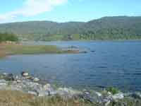
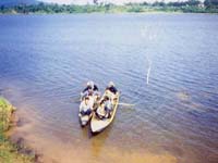
Tha Krabak Reservoir:
Built under
H.M.the King's project to improve the irrigation, the reservoir is
located in Moo 7 Tambon Tha Yaek, about 32 kilometers from town. It
is a dam that is 17.50 meters high, and 720 meters long, surrounded
by various kinds of forests. Its spectacular views are most suitable
for relaxation. A waterfall is near the reservoir, with 3 levels
which are 400-500 meters apart.
Chong Klam Bon Wildlife Sanctuary:
Located at Tambon Nong
Mak Fai, this site has the area of approximately 430 Rai. The
accessibility to this area is by using the same route to Pang Sida
National Park, pass Tha Krabak Reservoir for about 500 meters, turn
left for about 3 kilometers. Under Wildlife Sanctuary Bureau of
Forestry Department, this sanctuary has been established in 1983,
initiated by H.M.the Queen Sirikit to conserve rare and wild animals,
such as wild birds and mammals. This sanctuary also conducts studies
and researches on wild animals, and disseminates information, and
knowledge in wildlife.
Khao Chakan:
This mountain is about
17 kilometers from the city, on highway no.317 (Sa Kaeo - Chantaburi)
between 131st-132nd kilometers. The highest point is about 240
meters. There are 72 interesting caves. On the foot of the mount, is
the location of Wat Khao Chakan and a botanical garden. There are
stairs to the top which is a good viewpoint
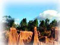
Phae
Mueang Phee 2:
Located at Ban Khlong
Yang, Tambon Thap Raj, this venue is a large area of about 800 acres
with many earth pillars in various shapes like the ones in Phrae
Province. They are indeed an amazingly beautiful site of nature
wonder. At Ban Khlong Yang, home-stay trip is available.
|
|
 |
 |
|
|
|
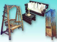
Local Products and Souvenirs
Wood Products Many
furniture and utensils made from various kinds of woods are on sale
in Wang Nam Yen.
Mother of Pearl Products There are various styles which are made at
Ban Hua Jode, Wattana Nakhon. Samples of the products are tables,
frames, clocks, containers, etc.
Khao Lam (sticky rice in
bamboo) A popular delicacy of the Wattana Nakhon.
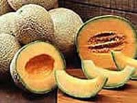
Cantaloupe A most typical fruit of the area and is grown and
available in Wattana Nakhon.
Suan Siriporn on Sa Kaeo - Chantaburi highway, in Wang Nam Yen, is
reputed for the variety of fruits.
Suan Niran Grand of
Wattana Nakhon is the site for many types of tangarines and fruits.
Second-Hand Goods are available in Aranyaprathe and Talad Rong Kluea
near Thai-Cambodian border.
Silk and Cotton Products are available at Ban San Sai of
Aranyaprathet.
Artificial Flowers, Fruits, Aromatic incense sticks are made at Ban
Kaeng, Amphoe Muang.
Festivals and Fairs
Eastern Cultural Fair and
Sa Kaeo Red Cross Fair. These fairs are held in the middle of
February every year. There are many traditional displays,
processions, exhibitions and cultural entertainments.
Sa Kaeo Establishment Commemoration Being held every year in
December, this special fair has many delightful events to offer.
There are cultural and arts processions, including exhibitions of
the local goods of the province.
Cantaloupe Day Held in Aranyaprathet in early April every year,
there are many activities in relation to cantaloupes for visitors to
the province to experience.
|
| |
|
|
|
|
